
Thank you for supporting this site ❤️
Make a donation
Make a donation
Gear up for your next adventure:
As an Amazon Associate, this site earns from qualifying purchases at no extra cost to you.
Padriñán topographic map
Click on the map to display elevation.
Thank you for supporting this site ❤️
Make a donation
Make a donation
Gear up for your next adventure:
As an Amazon Associate, this site earns from qualifying purchases at no extra cost to you.
About this map
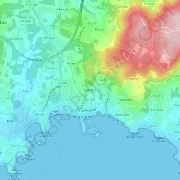
Name: Padriñán topographic map, elevation, terrain.
Location: Padriñán, Sanxenxo, Salnés, Pontevedra, Galicia, 36960, España (42.38615 -8.82435 42.42615 -8.78435)
Average elevation: 61 m
Minimum elevation: -2 m
Maximum elevation: 260 m
Thank you for supporting this site ❤️
Make a donation
Make a donation
Gear up for your next adventure:
As an Amazon Associate, this site earns from qualifying purchases at no extra cost to you.