Geolocate

Chandikhol topographic map

Click on the map to display elevation.

About this map

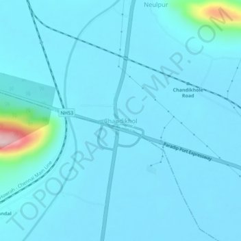
Name: Chandikhol topographic map, elevation, terrain.

Location: Chandikhol, Dharmasala, Jajpur, Odisha, 755044, India (20.68120 86.11457 20.72120 86.15457)

Average elevation: 33 m

Minimum elevation: 12 m

Maximum elevation: 300 m

Gear up for your next adventure:

🧰Multitool Knife - Compact and versatile tool for outdoor use
🧴Insect Repellent - Protect yourself from bugs during outdoor adventures
🥾Lightweight Hiking Shoes - Comfortable shoes for day hikes
Camping Essentials - All-in-one gear for a comfortable camping trip
🔨Vehicle Emergency Tool - Safety tool for remote road trips to trailheads

As an Amazon Associate, this site earns from qualifying purchases at no extra cost to you.