
Thank you for supporting this site ❤️
Make a donation
Make a donation
Gear up for your next adventure:
As an Amazon Associate, this site earns from qualifying purchases at no extra cost to you.
Miyoora I topographic map
Click on the map to display elevation.
Thank you for supporting this site ❤️
Make a donation
Make a donation
Gear up for your next adventure:
As an Amazon Associate, this site earns from qualifying purchases at no extra cost to you.
About this map
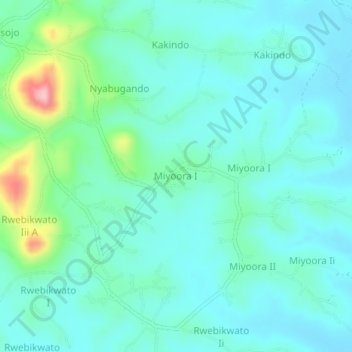
Name: Miyoora I topographic map, elevation, terrain.
Location: Miyoora I, Kamwenge, Western Region, Uganda (0.32452 30.51307 0.36452 30.55307)
Average elevation: 1,271 m
Minimum elevation: 1,232 m
Maximum elevation: 1,433 m
Thank you for supporting this site ❤️
Make a donation
Make a donation
Gear up for your next adventure:
As an Amazon Associate, this site earns from qualifying purchases at no extra cost to you.