Geolocate

Rotherham topographic map

Click on the map to display elevation.

About this map

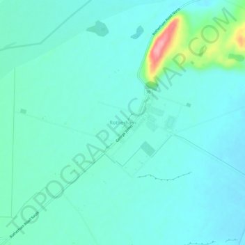
Name: Rotherham topographic map, elevation, terrain.

Location: Rotherham, Hurunui District, Canterbury, 7379, New Zealand (-42.71748 172.92266 -42.67748 172.96266)

Average elevation: 188 m

Minimum elevation: 167 m

Maximum elevation: 292 m

Other topographic maps

Click on a map to view its topography, its elevation and its terrain.

Conway River

New Zealand > Canterbury > Hurunui District

Average elevation: 484 m

Waipapa

New Zealand > Canterbury > Hurunui District

Average elevation: 72 m

Leithfield

New Zealand > Canterbury > Hurunui District

Average elevation: 16 m

Towy River

New Zealand > Canterbury > Hurunui District

Average elevation: 743 m

Waipapa

New Zealand > Canterbury > Hurunui District

Average elevation: 72 m

Gear up for your next adventure:

🔦LED Headlamp - Hands-free lighting for early morning starts or late finishes
🔥Emergency Fire Starter - Reliable ignition source for all weather conditions
🥾Trekking Poles - Adjustable trekking poles to reduce knee stress and improve stability
Tent Footprint - Protect tent floor and increase durability
🔨Vehicle Emergency Tool - Safety tool for remote road trips to trailheads

As an Amazon Associate, this site earns from qualifying purchases at no extra cost to you.