Geolocate

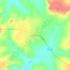
Peixe topographic map

Click on the map to display elevation.

About this map

Name: Peixe topographic map, elevation, terrain.

Location: Peixe, Região Geográfica Imediata de Gurupi, Região Geográfica Intermediária de Gurupi, Tocantins, North Region, 77460-000, Brazil (-12.49700 -49.00883 -11.36300 -48.10100)

Average elevation: 283 m

Minimum elevation: 215 m

Maximum elevation: 734 m

Other topographic maps

Click on a map to view its topography, its elevation and its terrain.
Praia do Segredo

Brazil > Tocantins > Lajeado

Average elevation: 209 m

Campina Verde

Brazil > Tocantins

Average elevation: 271 m

Gear up for your next adventure:

❄️Traction Ice Cleats - Slip-on spikes for icy trails and winter hiking
🧤Rechargeable Heated Gloves - Extreme warmth for Canadian winter expeditions
🩹Moleskin Blister Pads - Direct protection for painful foot pressure points
🛶Kayak Dry Bag - Waterproof storage for kayaking adventures
📷Outdoor Action Camera - Capture high-elevation views and rugged adventures

As an Amazon Associate, this site earns from qualifying purchases at no extra cost to you.