Geolocate

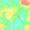
Peixe topographic map

Click on the map to display elevation.

About this map

Name: Peixe topographic map, elevation, terrain.

Location: Peixe, Região Geográfica Imediata de Gurupi, Região Geográfica Intermediária de Gurupi, Tocantins, North Region, 77460-000, Brazil (-12.49700 -49.00883 -11.36300 -48.10100)

Average elevation: 283 m

Minimum elevation: 215 m

Maximum elevation: 734 m

Other topographic maps

Click on a map to view its topography, its elevation and its terrain.
Praia do Segredo

Brazil > Tocantins > Lajeado

Average elevation: 209 m

Campina Verde

Brazil > Tocantins

Average elevation: 271 m

Gear up for your next adventure:

🧢Beanie Hat - Keep your head warm in cold weather
⛺Family Camping Tent - Spacious tent suitable for family camping trips
🧢Outdoor Cap - Protective cap for sun and rain during hikes
🚑Survival Whistle - Signal for help across long distances in mountains
🎒Backpack Rain Cover - External shield to keep your entire pack dry

As an Amazon Associate, this site earns from qualifying purchases at no extra cost to you.