Geolocate

Weiding topographic map

Click on the map to display elevation.

About this map

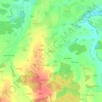
Name: Weiding topographic map, elevation, terrain.

Location: Weiding, Schnaitsee, Landkreis Traunstein, Bayern, Deutschland (48.06309 12.42363 48.10309 12.46363)

Average elevation: 532 m

Minimum elevation: 491 m

Maximum elevation: 584 m

Gear up for your next adventure:

🧥Softshell Jacket - Windproof and breathable jacket for hiking
🥤Collapsible Travel Cup - Saves space and weight in your mess kit
🌡️Emergency Mylar Blankets - Compact thermal protection for unexpected nights outdoors
💡Portable Camping Lamp - Rechargeable lamp for campsite lighting
🧭GPS Outdoor Watch - Smart watch for navigation and fitness tracking in nature

As an Amazon Associate, this site earns from qualifying purchases at no extra cost to you.