
Thank you for supporting this site ❤️
Make a donation
Make a donation
Gear up for your next adventure:
As an Amazon Associate, this site earns from qualifying purchases at no extra cost to you.
Miyashiro topographic map
Click on the map to display elevation.
Thank you for supporting this site ❤️
Make a donation
Make a donation
Gear up for your next adventure:
As an Amazon Associate, this site earns from qualifying purchases at no extra cost to you.
About this map
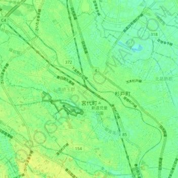
Name: Miyashiro topographic map, elevation, terrain.
Location: Miyashiro, Minami-Saitama County, Saitama Prefecture, Japan (35.99696 139.68251 36.05769 139.75315)
Average elevation: 9 m
Minimum elevation: 1 m
Maximum elevation: 17 m
Thank you for supporting this site ❤️
Make a donation
Make a donation
Gear up for your next adventure:
As an Amazon Associate, this site earns from qualifying purchases at no extra cost to you.