Geolocate

Flint Hills topographic map

Click on the map to display elevation.

About this map

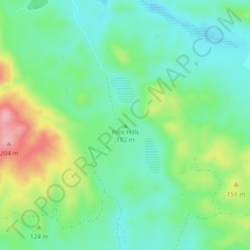
Name: Flint Hills topographic map, elevation, terrain.

Location: Flint Hills, San Benito County, California, United States (36.87851 -121.46832 36.87861 -121.46822)

Average elevation: 105 m

Minimum elevation: 62 m

Maximum elevation: 196 m

Other topographic maps

Click on a map to view its topography, its elevation and its terrain.

Gear up for your next adventure:

🚲MTB Frame Bag - Carry tools and maps directly on your bicycle frame
🧶550 Survival Paracord - Versatile utility cord for emergency repairs and rigging
🦯Trekking Poles - Reduced impact on joints for steep topographic climbs
🥾Trail Running Shoes - Lightweight and durable shoes for trail running
🧦Thermal Socks - Warm socks for winter hiking or camping

As an Amazon Associate, this site earns from qualifying purchases at no extra cost to you.