Geolocate

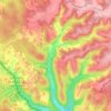
L'Herm topographic map

Click on the map to display elevation.

About this map

Name: L'Herm topographic map, elevation, terrain.

Location: L'Herm, Rouffignac, Rouffignac-Saint-Cernin-de-Reilhac, Sarlat-la-Canéda, Dordogne, Nouvelle-Aquitaine, France métropolitaine, 24580, France (45.05843 0.94069 45.09843 0.98069)

Average elevation: 238 m

Minimum elevation: 181 m

Maximum elevation: 306 m

Other topographic maps

Click on a map to view its topography, its elevation and its terrain.
Gear up for your next adventure:

🔋Emergency Crank Radio - Weather alerts and power without needing batteries
🧥Waterproof Hiking Jacket - Protect yourself from rain and wind while hiking
🪜Heavy Duty Carabiners - Multi-use clips for securing gear to your backpack
🧣Merino Neck Gaiter - Protects against wind, sun, and cold at high altitudes
🧥Softshell Jacket - Windproof and breathable jacket for hiking

As an Amazon Associate, this site earns from qualifying purchases at no extra cost to you.