Geolocate

La Hermida topographic map

Click on the map to display elevation.

About this map

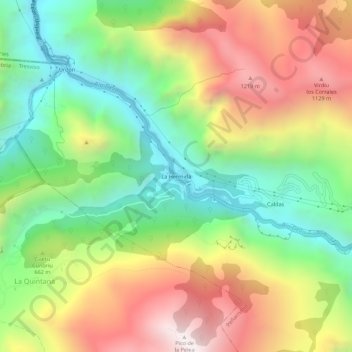
Name: La Hermida topographic map, elevation, terrain.

Location: La Hermida, Peñarrubia, Cantabria, 39580, Spain (43.23491 -4.63484 43.27491 -4.59484)

Average elevation: 633 m

Minimum elevation: 68 m

Maximum elevation: 1,364 m

Gear up for your next adventure:

🥾Mountain Hiking Boots - High-traction boots for rocky terrain
🧳Compression Sacks - Maximize space in your backpack by shrinking gear
🕶️Polarized Sunglasses - Reduces glare from snow and water at high elevations
🥾Hiking Shoes - Durable and comfortable shoes for trail hiking
🧴Sunscreen SPF - Broad-spectrum sunscreen for outdoor activities

As an Amazon Associate, this site earns from qualifying purchases at no extra cost to you.