Geolocate

Chila topographic map

Click on the map to display elevation.

About this map

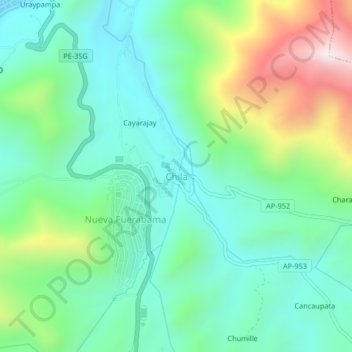
Name: Chila topographic map, elevation, terrain.

Location: Chila, Challhuahuacho, Cotabambas, Apurímac, Perú (-14.15092 -72.24127 -14.11092 -72.20127)

Average elevation: 3,918 m

Minimum elevation: 3,684 m

Maximum elevation: 4,500 m

Gear up for your next adventure:

🥾Approach Shoes - Shoes designed for climbing approaches and rugged trails
🥾Mountaineering Boots - Supportive boots for climbing and high-altitude hiking
🧦Hiking Socks - Moisture-wicking and comfortable socks for long hikes
Family Camping Tent - Spacious tent suitable for family camping trips
🚲Handlebar Phone Mount - View topographic-map.com live while cycling

As an Amazon Associate, this site earns from qualifying purchases at no extra cost to you.