Geolocate

Speedwell topographic map

Click on the map to display elevation.

About this map

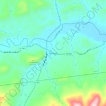
Name: Speedwell topographic map, elevation, terrain.

Location: Speedwell, Wythe County, Virginia, 24374, United States (36.79373 -81.19176 36.83373 -81.15176)

Average elevation: 754 m

Minimum elevation: 681 m

Maximum elevation: 1,000 m

Other topographic maps

Click on a map to view its topography, its elevation and its terrain.

Rural Retreat

United States > Virginia > Wythe County

Average elevation: 777 m

Gear up for your next adventure:

👟Leg Gaiters - Keep debris, mud, and snow out of your boots
🏕️Camping Hammock - Integrated protection for sleeping between trees
Lightweight Camping Tent - Portable shelter optimized for Canadian backcountry camping
🧥Thermal Layer - Insulating layer for cold outdoor conditions
🧴Insect Repellent - Protect yourself from bugs during outdoor adventures

As an Amazon Associate, this site earns from qualifying purchases at no extra cost to you.