Geolocate

Callo topographic map

Click on the map to display elevation.

About this map

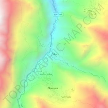
Name: Callo topographic map, elevation, terrain.

Location: Callo, Santa Rita, San Pedro de Chaná, Province of Huari, Ancash, Peru (-9.43951 -77.04406 -9.39951 -77.00406)

Average elevation: 3,451 m

Minimum elevation: 2,808 m

Maximum elevation: 4,274 m

Gear up for your next adventure:

🎒Hiking Daypack - Lightweight and durable backpacks for day trips and excursions
🦶Anti-Blister Balm - Prevents friction and hotspots during long ascents
🛌Down Sleeping Bag - Superior warmth-to-weight ratio for cold nights
🧥Insulated Jacket - Keep warm in cold outdoor conditions
🏕️Camping Hammock - Integrated protection for sleeping between trees

As an Amazon Associate, this site earns from qualifying purchases at no extra cost to you.