
Thank you for supporting this site ❤️
Make a donation
Make a donation
Gear up for your next adventure:
As an Amazon Associate, this site earns from qualifying purchases at no extra cost to you.
Şimşirlik topographic map
Click on the map to display elevation.
Thank you for supporting this site ❤️
Make a donation
Make a donation
Gear up for your next adventure:
As an Amazon Associate, this site earns from qualifying purchases at no extra cost to you.
About this map
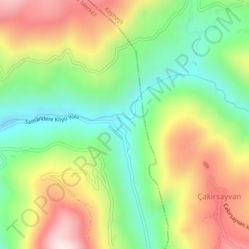
Name: Şimşirlik topographic map, elevation, terrain.
Location: Şimşirlik, Düzce, Black Sea Region, Turkey (40.71654 31.25169 40.73654 31.27169)
Average elevation: 644 m
Minimum elevation: 386 m
Maximum elevation: 986 m
Thank you for supporting this site ❤️
Make a donation
Make a donation
Gear up for your next adventure:
As an Amazon Associate, this site earns from qualifying purchases at no extra cost to you.