
Thank you for supporting this site ❤️
Make a donation
Make a donation
Gear up for your next adventure:
As an Amazon Associate, this site earns from qualifying purchases at no extra cost to you.
Yeşiltepe topographic map
Click on the map to display elevation.
Thank you for supporting this site ❤️
Make a donation
Make a donation
Gear up for your next adventure:
As an Amazon Associate, this site earns from qualifying purchases at no extra cost to you.
About this map
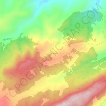
Name: Yeşiltepe topographic map, elevation, terrain.
Location: Yeşiltepe, Merzifon, Amasya, Black Sea Region, Turkey (40.65407 35.40612 40.69407 35.44612)
Average elevation: 1,033 m
Minimum elevation: 799 m
Maximum elevation: 1,259 m
Thank you for supporting this site ❤️
Make a donation
Make a donation
Gear up for your next adventure:
As an Amazon Associate, this site earns from qualifying purchases at no extra cost to you.