Geolocate

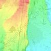
Maggiora topographic map

Click on the map to display elevation.

About this map

Name: Maggiora topographic map, elevation, terrain.

Location: Maggiora, Novara, Piemonte, 28014, Italia (45.67462 8.38071 45.72122 8.44678)

Average elevation: 382 m

Minimum elevation: 296 m

Maximum elevation: 633 m

Other topographic maps

Click on a map to view its topography, its elevation and its terrain.

Coiromonte

Italia > Piemonte > Novara

Average elevation: 739 m

Fosseno

Italia > Piemonte > Novara

Average elevation: 548 m

Gaggiolo

Italia > Piemonte > Novara

Average elevation: 211 m

Tabarino

Italia > Piemonte > Novara

Average elevation: 555 m

Gear up for your next adventure:

🧶550 Survival Paracord - Versatile utility cord for emergency repairs and rigging
🥾Hiking Gaiters - Protect legs and shoes from mud, snow, and debris
💡LED Camping Lantern - Illuminate your campsite with long-lasting lanterns
🥾Hiking Shoes - Durable and comfortable shoes for trail hiking
🏃Hydration Running Vest - Carry water and maps close to your body for speed

As an Amazon Associate, this site earns from qualifying purchases at no extra cost to you.