Geolocate

Yangfang topographic map

Click on the map to display elevation.

About this map

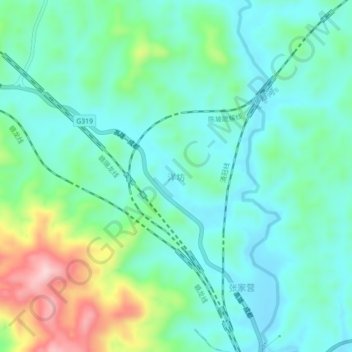
Name: Yangfang topographic map, elevation, terrain.

Location: Yangfang, Longyan City, Fujian, China (25.53763 116.64138 25.57763 116.68138)

Average elevation: 401 m

Minimum elevation: 335 m

Maximum elevation: 599 m

Other topographic maps

Click on a map to view its topography, its elevation and its terrain.

Yongding District

China > Fujian > Longyan City

Average elevation: 506 m

Gear up for your next adventure:

🧥Softshell Hiking Jacket - The perfect balance of wind protection and breathability
Backpacking Tent - Lightweight tent for long-distance hiking trips
🦟Insect Repellent - Keep mosquitoes and black flies away in wooded areas
🧣Merino Neck Gaiter - Protects against wind, sun, and cold at high altitudes
🧰Emergency Multi-Tool - Compact multi-tool for outdoor survival

As an Amazon Associate, this site earns from qualifying purchases at no extra cost to you.