
Thank you for supporting this site ❤️
Make a donation
Make a donation
Gear up for your next adventure:
As an Amazon Associate, this site earns from qualifying purchases at no extra cost to you.
Cunurana topographic map
Click on the map to display elevation.
Thank you for supporting this site ❤️
Make a donation
Make a donation
Gear up for your next adventure:
As an Amazon Associate, this site earns from qualifying purchases at no extra cost to you.
About this map
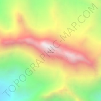
Name: Cunurana topographic map, elevation, terrain.
Location: Cunurana, Santa Rosa, Province of Melgar, Puno, Peru (-14.54858 -70.83140 -14.54848 -70.83130)
Average elevation: 4,912 m
Minimum elevation: 4,337 m
Maximum elevation: 5,406 m
Thank you for supporting this site ❤️
Make a donation
Make a donation
Gear up for your next adventure:
As an Amazon Associate, this site earns from qualifying purchases at no extra cost to you.