Geolocate

Reinhardt topographic map

Click on the map to display elevation.

About this map

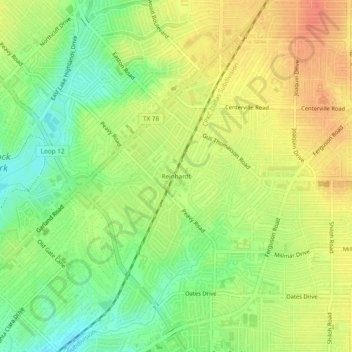
Name: Reinhardt topographic map, elevation, terrain.

Location: Reinhardt, Dallas, Dallas County, Texas, 75218, United States (32.81513 -96.70916 32.85513 -96.66916)

Average elevation: 164 m

Minimum elevation: 138 m

Maximum elevation: 187 m

Other topographic maps

Click on a map to view its topography, its elevation and its terrain.

Kessler Parkway

United States > Texas > Dallas County > Dallas

Average elevation: 137 m

Klyde Warren Park

United States > Texas > Dallas County > Dallas

Average elevation: 142 m

Lake Shirley

United States > Texas > Dallas County > Dallas

Average elevation: 199 m

Dealey Plaza

United States > Texas > Dallas County > Dallas

Average elevation: 132 m

Dealey Plaza

United States > Texas > Dallas County > Dallas

Average elevation: 132 m

Klyde Warren Park

United States > Texas > Dallas County > Dallas

Average elevation: 142 m

Gear up for your next adventure:

🥾Trail Hiking Socks - Comfortable socks to prevent blisters and fatigue
🧴Waterproofing Spray - Restore the DWR coating on jackets and tents
🥾Approach Shoes - Shoes designed for climbing approaches and rugged trails
🧰Multitool Knife - Compact and versatile tool for outdoor use
🧥Packable Rain Jacket - Breathable waterproof layer for unpredictable weather

As an Amazon Associate, this site earns from qualifying purchases at no extra cost to you.