Shenandoah River topographic map
Click on the map to display elevation.
Shenandoah River
The Shenandoah Valley is underlaid by limestone. The fertile soil made it a favored place for early settlement. It remains a major agricultural area of Virginia and West Virginia. Some karst topography is evident, and the limestone is honeycombed with caves. Several have been developed as commercial tourist attractions, including Luray Caverns, Shenandoah Caverns, and Skyline Caverns.
About this map
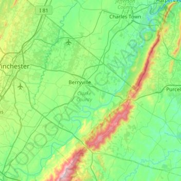
Name: Shenandoah River topographic map, elevation, terrain.
Location: Shenandoah River, Clarke County, Virginia, United States (38.94432 -78.18877 39.32266 -77.72598)
Average elevation: 197 m
Minimum elevation: 70 m
Maximum elevation: 665 m
Other topographic maps
Click on a map to view its topography, its elevation and its terrain.