Geolocate

Brayj topographic map

Click on the map to display elevation.

About this map
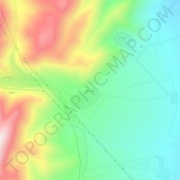
Name: Brayj topographic map, elevation, terrain.

Location: Brayj, Hermel, Hermel District, Baalbek-Hermel Governorate, Lebanon (34.43527 36.36189 34.47527 36.40189)

Average elevation: 905 m

Minimum elevation: 681 m

Maximum elevation: 1,290 m

Other topographic maps

Click on a map to view its topography, its elevation and its terrain.

Shmestar

Lebanon > Baalbek-Hermel Governorate

Average elevation: 1,210 m

Deir El Ahmar

Lebanon > Baalbek-Hermel Governorate

Average elevation: 1,148 m

Maqnah

Lebanon > Baalbek-Hermel Governorate

Average elevation: 1,063 m

Baalbek

Lebanon > Baalbek-Hermel Governorate

Average elevation: 1,218 m

Taraya

Lebanon > Baalbek-Hermel Governorate

Average elevation: 1,551 m

Harbata

Lebanon > Baalbek-Hermel Governorate

Average elevation: 1,307 m

Beit Shama

Lebanon > Baalbek-Hermel Governorate

Average elevation: 1,056 m

Hermel

Lebanon > Baalbek-Hermel Governorate

Average elevation: 813 m

Beshwat

Lebanon > Baalbek-Hermel Governorate

Average elevation: 1,321 m

Gear up for your next adventure:

⛺Lightweight Camping Tent - Portable shelter optimized for Canadian backcountry camping
🧥Ultralight Puffy Jacket - Maximum warmth that packs down to the size of an orange
🎒Backpack Rain Cover - External shield to keep your entire pack dry
🥾Light Trekking Boots - Supportive boots for multi-day treks
💧Hydration Pack - Hands-free hydration system for long hikes

As an Amazon Associate, this site earns from qualifying purchases at no extra cost to you.