Geolocate

Kehancha topographic map

Click on the map to display elevation.

About this map

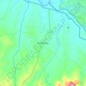
Name: Kehancha topographic map, elevation, terrain.

Location: Kehancha, Bukira East ward, Kuria West, Migori County, Kenya (-1.23326 34.58001 -1.15326 34.66001)

Average elevation: 1,468 m

Minimum elevation: 1,402 m

Maximum elevation: 1,726 m

Gear up for your next adventure:

❄️Traction Ice Cleats - Slip-on spikes for icy trails and winter hiking
🌡️Emergency Mylar Blankets - Compact thermal protection for unexpected nights outdoors
🧥Packable Rain Jacket - Breathable waterproof layer for unpredictable weather
🩹Moleskin Blister Pads - Direct protection for painful foot pressure points
🧭GPS Handheld Device - Reliable GPS navigation for outdoor adventures

As an Amazon Associate, this site earns from qualifying purchases at no extra cost to you.