Geolocate

Lubmin topographic map

Click on the map to display elevation.

About this map

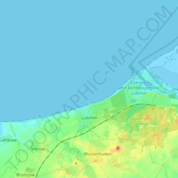
Name: Lubmin topographic map, elevation, terrain.

Location: Lubmin, Vorpommern-Greifswald, Mecklenburg-Vorpommern, Germany (54.11757 13.57935 54.17203 13.71759)

Average elevation: 7 m

Minimum elevation: -4 m

Maximum elevation: 43 m

Gear up for your next adventure:

🥾Light Trekking Boots - Supportive boots for multi-day treks
🦶Anti-Blister Balm - Prevents friction and hotspots during long ascents
🧭Orienteering Kit - Tools for map reading and navigation in the wild
🧥Softshell Hiking Jacket - The perfect balance of wind protection and breathability
🏃Hydration Running Vest - Carry water and maps close to your body for speed

As an Amazon Associate, this site earns from qualifying purchases at no extra cost to you.