Geolocate

Basot topographic map

Click on the map to display elevation.

About this map

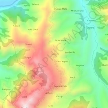
Name: Basot topographic map, elevation, terrain.

Location: Basot, Bhikiasain, Almora, Uttarakhand, 263680, India (29.63485 79.24224 29.67485 79.28224)

Average elevation: 1,105 m

Minimum elevation: 745 m

Maximum elevation: 1,550 m

Gear up for your next adventure:

🐕Hiking Dog Pack - Let your canine companion carry their own water and food
🔭Compact Binoculars - Lightweight optics for scouting trails and wildlife
🧢Hiking Sun Hat - Wide-brimmed protection for exposed mountain ridges
🥾Lightweight Hiking Shoes - Comfortable shoes for day hikes
🔋Emergency Crank Radio - Weather alerts and power without needing batteries

As an Amazon Associate, this site earns from qualifying purchases at no extra cost to you.