Geolocate

Kayyar topographic map

Click on the map to display elevation.

About this map

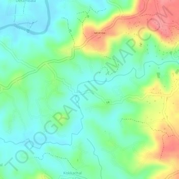
Name: Kayyar topographic map, elevation, terrain.

Location: Kayyar, Kandal, Manjeswaram, Kasaragod, Kerala, India (12.66341 74.95246 12.67669 74.97913)

Average elevation: 43 m

Minimum elevation: 9 m

Maximum elevation: 102 m

Gear up for your next adventure:

🕶️Polarized Sunglasses - Protect your eyes with durable polarized lenses
🧥Waterproof Jacket - Lightweight rain jackets for hiking and outdoor activities
🦯Trekking Poles - Reduced impact on joints for steep topographic climbs
🧴Insect Repellent - Protect yourself from bugs during outdoor adventures
🥾Hiking Leggings - Comfortable leggings for outdoor activities

As an Amazon Associate, this site earns from qualifying purchases at no extra cost to you.