Geolocate

Digboi topographic map

Click on the map to display elevation.

About this map
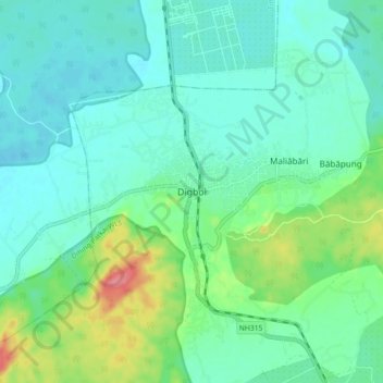
Name: Digboi topographic map, elevation, terrain.

Location: Digboi, Margherita, Tinsukia, Assam, 786171, India (27.35561 95.57487 27.43561 95.65487)

Average elevation: 151 m

Minimum elevation: 131 m

Maximum elevation: 215 m

Gear up for your next adventure:

🔥Camping Stove - Portable stoves to cook outdoors with ease
🧢Outdoor Cap - Protective cap for sun and rain during hikes
🥾Hiking Shoes - Durable and comfortable shoes for trail hiking
🧭GPS Handheld Device - Reliable GPS navigation for outdoor adventures
🐕Hiking Dog Pack - Let your canine companion carry their own water and food

As an Amazon Associate, this site earns from qualifying purchases at no extra cost to you.