Geolocate

Taganga topographic map

Click on the map to display elevation.

About this map

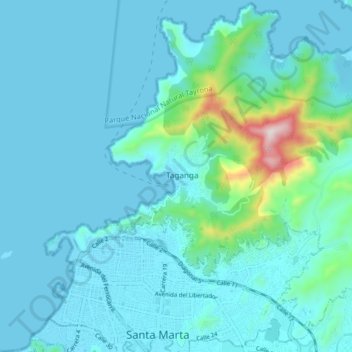
Name: Taganga topographic map, elevation, terrain.

Location: Taganga, Santa Marta, Magdalena, 470004, Colombia (11.22818 -74.23082 11.30818 -74.15082)

Average elevation: 67 m

Minimum elevation: -1 m

Maximum elevation: 581 m

Gear up for your next adventure:

🥾Waterproof Hiking Boots - Essential footwear for rugged terrain and wet Canadian trails
👟Leg Gaiters - Keep debris, mud, and snow out of your boots
🏕️Camping Hammock - Integrated protection for sleeping between trees
🥾Hiking Gaiters - Protect legs and shoes from mud, snow, and debris
🧭GPS Handheld Device - Reliable GPS navigation for outdoor adventures

As an Amazon Associate, this site earns from qualifying purchases at no extra cost to you.