Geolocate

Olmedillas topographic map

Click on the map to display elevation.

About this map

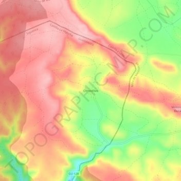
Name: Olmedillas topographic map, elevation, terrain.

Location: Olmedillas, Sigüenza, Guadalajara, Castilla-La Mancha, España (41.15319 -2.61053 41.19319 -2.57053)

Average elevation: 1,175 m

Minimum elevation: 1,082 m

Maximum elevation: 1,231 m

Other topographic maps

Click on a map to view its topography, its elevation and its terrain.

Riosalido

España > Castilla-La Mancha > Sigüenza

Average elevation: 1,041 m

Gear up for your next adventure:

🧶550 Survival Paracord - Versatile utility cord for emergency repairs and rigging
🚲MTB Frame Bag - Carry tools and maps directly on your bicycle frame
🔥Emergency Fire Starter - Reliable ignition source for all weather conditions
🥾Trail Hiking Boots - Supportive boots for rough trails
🧢Outdoor Cap - Protective cap for sun and rain during hikes

As an Amazon Associate, this site earns from qualifying purchases at no extra cost to you.