Geolocate

Gairsain topographic map

Click on the map to display elevation.

About this map

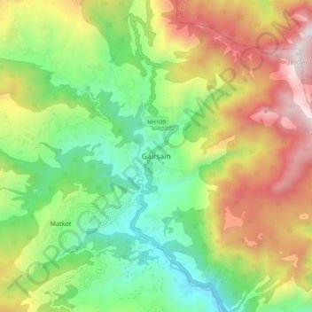
Name: Gairsain topographic map, elevation, terrain.

Location: Gairsain, Chamoli, Uttarakhand, 246428, India (30.01462 79.24999 30.09462 79.32999)

Average elevation: 1,980 m

Minimum elevation: 1,363 m

Maximum elevation: 2,873 m

Gear up for your next adventure:

🔨Vehicle Emergency Tool - Safety tool for remote road trips to trailheads
🥾Lightweight Hiking Boots - Boots for comfort and mobility on long hikes
🧴Bear Spray Holster - Quick-access carry for essential Canadian wilderness safety
🧢Hiking Sun Hat - Wide-brimmed protection for exposed mountain ridges
🥾Trail Running Shoes - Lightweight and durable shoes for trail running

As an Amazon Associate, this site earns from qualifying purchases at no extra cost to you.