
Huarautambo topographic map
Click on the map to display elevation.
About this map
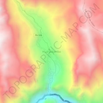
Name: Huarautambo topographic map, elevation, terrain.
Average elevation: 3,931 m
Minimum elevation: 3,240 m
Maximum elevation: 4,371 m
Other topographic maps
Click on a map to view its topography, its elevation and its terrain.
Province of Oxapampa
Oxapampa is the largest of three provinces that make up the Pasco Region in Peru. The capital of the province is the city of Oxapampa. The province is located on the eastern slopes of the Andes reaching down to the lowlands of the Amazon Basin. The high point of the province is approximately 5,300 metres…
Average elevation: 1,348 m
Villa Rica
The District of Villa Rica is on the eastern slopes of the Andes mountains in an area of abundant rainfall and mild temperatures. It is located in the ecological zone of the Peruvian Yungas, or Ceja de Selva ("eyebrow of the jungle"), the transition zone between the low jungles of the Amazon Basin and the…
Average elevation: 1,708 m