Geolocate

Paroni topographic map

Click on the map to display elevation.

About this map

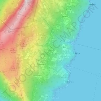
Name: Paroni topographic map, elevation, terrain.

Location: Paroni, Zagorje, Općina Kršan, Istria County, 52234, Croatia (45.13071 14.19399 45.17071 14.23399)

Average elevation: 265 m

Minimum elevation: -1 m

Maximum elevation: 813 m

Gear up for your next adventure:

🛁Quick-Dry Microfiber Towel - Space-saving towel that dries rapidly on the move
🥾Lightweight Hiking Boots - Boots for comfort and mobility on long hikes
🧥Softshell Hiking Jacket - The perfect balance of wind protection and breathability
Lightweight Camping Tent - Portable shelter optimized for Canadian backcountry camping
🧰Survival Kit - Essential gear for emergencies in the wilderness

As an Amazon Associate, this site earns from qualifying purchases at no extra cost to you.