
Thank you for supporting this site ❤️
Make a donation
Make a donation
Gear up for your next adventure:
As an Amazon Associate, this site earns from qualifying purchases at no extra cost to you.
Chã topographic map
Click on the map to display elevation.
Thank you for supporting this site ❤️
Make a donation
Make a donation
Gear up for your next adventure:
As an Amazon Associate, this site earns from qualifying purchases at no extra cost to you.
About this map
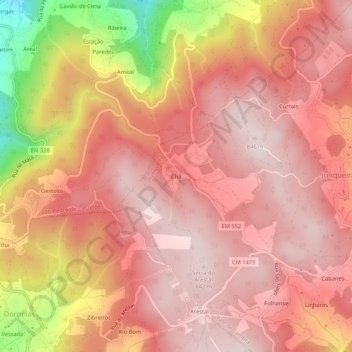
Name: Chã topographic map, elevation, terrain.
Location: Chã, Junqueira, Vale de Cambra, Aveiro, 3730-047, Portugal (40.78351 -8.38186 40.82351 -8.34186)
Average elevation: 694 m
Minimum elevation: 327 m
Maximum elevation: 839 m
Thank you for supporting this site ❤️
Make a donation
Make a donation
Gear up for your next adventure:
As an Amazon Associate, this site earns from qualifying purchases at no extra cost to you.