Geolocate

Portillo topographic map

Click on the map to display elevation.

About this map

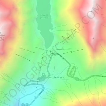
Name: Portillo topographic map, elevation, terrain.

Location: Portillo, Los Andes, Provincia de Los Andes, Valparaiso Region, Chile (-32.85642 -70.14908 -32.81642 -70.10908)

Average elevation: 3,196 m

Minimum elevation: 2,446 m

Maximum elevation: 4,234 m

Other topographic maps

Click on a map to view its topography, its elevation and its terrain.

Gear up for your next adventure:

🥾Trekking Boots - Durable boots for long-distance trekking
🧤Rechargeable Heated Gloves - Extreme warmth for Canadian winter expeditions
🥾Hiking Shoes - Durable and comfortable shoes for trail hiking
🧦Thermal Socks - Warm socks for winter hiking or camping
🛶Kayak Accessories - Essential gear for safe and fun kayaking adventures

As an Amazon Associate, this site earns from qualifying purchases at no extra cost to you.