Geolocate

Pattigham topographic map

Click on the map to display elevation.

About this map

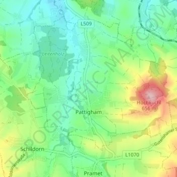
Name: Pattigham topographic map, elevation, terrain.

Location: Pattigham, Bezirk Ried, Upper Austria, 4910, Austria (48.13945 13.46320 48.18037 13.52209)

Average elevation: 521 m

Minimum elevation: 463 m

Maximum elevation: 647 m

Gear up for your next adventure:

🦶Anti-Blister Balm - Prevents friction and hotspots during long ascents
🍽️Titanium Camping Spork - Ultralight and indestructible eating utensil
🥾Mountain Hiking Shoes - Shoes with superior grip for mountainous terrain
🧴Outdoor Sunscreen - High SPF protection for high-altitude UV exposure
🔦LED Headlamp - Hands-free lighting for early morning starts or late finishes

As an Amazon Associate, this site earns from qualifying purchases at no extra cost to you.