Geolocate

Glidden topographic map

Click on the map to display elevation.

About this map
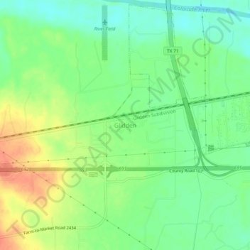
Name: Glidden topographic map, elevation, terrain.

Location: Glidden, Colorado County, Texas, 78943, United States (29.68051 -96.60786 29.72051 -96.56786)

Average elevation: 74 m

Minimum elevation: 54 m

Maximum elevation: 101 m

Other topographic maps

Click on a map to view its topography, its elevation and its terrain.

Columbus

United States > Texas > Colorado County

Average elevation: 61 m

Weimar

United States > Texas > Colorado County

Average elevation: 119 m

Eagle Lake

United States > Texas > Colorado County

Average elevation: 54 m

Weimar

United States > Texas > Colorado County

Average elevation: 119 m

Eagle Lake

United States > Texas > Colorado County

Average elevation: 54 m

Eagle Lake

United States > Texas > Colorado County

Average elevation: 54 m

Eagle Lake

United States > Texas > Colorado County

Average elevation: 54 m

Gear up for your next adventure:

🥾Hiking Shorts - Breathable shorts suitable for summer hikes
⛺Lightweight Backpacking Tent - Compact tent for efficient hiking trips
⛺Family Camping Tent - Spacious tent suitable for family camping trips
👟Trail Running Shoes - Agile footwear for fast-paced topographic exploration
🔥Emergency Fire Starter - Reliable ignition source for all weather conditions

As an Amazon Associate, this site earns from qualifying purchases at no extra cost to you.