Geolocate

Girona topographic map

Click on the map to display elevation.

About this map
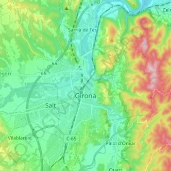
Name: Girona topographic map, elevation, terrain.

Location: Girona, Gironès, Girona, Catalonia, Spain (41.93924 2.78310 42.02973 2.89824)

Average elevation: 135 m

Minimum elevation: 40 m

Maximum elevation: 370 m

Other topographic maps

Click on a map to view its topography, its elevation and its terrain.

Sant Grau

Spain > Catalonia > Gironès > Sant Gregori

Average elevation: 251 m

Collsacarrera

Spain > Catalonia > Gironès > Canet d'Adri

Average elevation: 268 m

Gear up for your next adventure:

🥾Lightweight Hiking Boots - Boots for comfort and mobility on long hikes
🥾All-Terrain Hiking Boots - Versatile boots for varied hiking conditions
🪑Ultralight Camping Stool - Compact seating for rest stops during long hikes
⛺Camping Groundsheet - Protect your tent from moisture and dirt
🥾Light Hiking Boots - Lightweight and comfortable boots for day hikes

As an Amazon Associate, this site earns from qualifying purchases at no extra cost to you.