Geolocate

Eastern topographic map

Click on the map to display elevation.

About this map

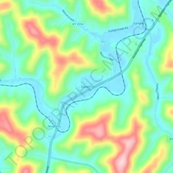
Name: Eastern topographic map, elevation, terrain.

Location: Eastern, Floyd County, Kentucky, 41622, United States (37.49704 -82.82599 37.53704 -82.78599)

Average elevation: 274 m

Minimum elevation: 196 m

Maximum elevation: 433 m

Gear up for your next adventure:

🎒Hiking Backpack - Lightweight and ergonomic backpacks for day hikes or multi-day treks
🦶Hiking Shoe Insoles - Added support for high arches and long days on feet
🔭Compact Binoculars - Lightweight optics for scouting trails and wildlife
🪜Heavy Duty Carabiners - Multi-use clips for securing gear to your backpack
🥾Hiking Shorts - Breathable shorts suitable for summer hikes

As an Amazon Associate, this site earns from qualifying purchases at no extra cost to you.