
Thank you for supporting this site ❤️
Make a donation
Make a donation
Gear up for your next adventure:
As an Amazon Associate, this site earns from qualifying purchases at no extra cost to you.
Casalonga topographic map
Click on the map to display elevation.
Thank you for supporting this site ❤️
Make a donation
Make a donation
Gear up for your next adventure:
As an Amazon Associate, this site earns from qualifying purchases at no extra cost to you.
About this map
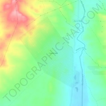
Name: Casalonga topographic map, elevation, terrain.
Location: Casalonga, Villar de Cañas, Cuenca, Castilla-La Mancha, España (39.81981 -2.61046 39.85981 -2.57046)
Average elevation: 844 m
Minimum elevation: 799 m
Maximum elevation: 926 m
Thank you for supporting this site ❤️
Make a donation
Make a donation
Gear up for your next adventure:
As an Amazon Associate, this site earns from qualifying purchases at no extra cost to you.