Geolocate

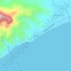
Palingowak topographic map

Click on the map to display elevation.

About this map

Name: Palingowak topographic map, elevation, terrain.

Location: Palingowak, San Juan, Batangas, Calabarzon, Philippines (13.81172 121.41043 13.82596 121.42893)

Average elevation: 11 m

Minimum elevation: 4 m

Maximum elevation: 18 m

Other topographic maps

Click on a map to view its topography, its elevation and its terrain.
Ticalan

Philippines > Batangas > San Juan > Ticalan

Average elevation: 8 m

Hugom

Philippines > Batangas > San Juan > Hugom

Average elevation: 76 m

Malaking Tubig River

Philippines > Batangas > San Juan

Average elevation: 10 m

Gear up for your next adventure:

🏃Hydration Running Vest - Carry water and maps close to your body for speed
🥾Lightweight Hiking Boots - Boots for comfort and mobility on long hikes
🚲Bike Repair Kit - Essential tools for on-trail mechanical issues
🐕Hiking Dog Pack - Let your canine companion carry their own water and food
🧤Insulated Winter Gloves - Heavy-duty protection for sub-zero Canadian adventures

As an Amazon Associate, this site earns from qualifying purchases at no extra cost to you.