Elm topographic map
Click on the map to display elevation.
Elm
The village of Elm is situated at an elevation of 977 m (3,205 ft) on the left bank of the Sernf river. It is the farthest village upstream in the valley of the Sernf, with the village of Matt downstream and to the north. Elm lies on the road from Schwanden, although the road continues higher up the valley to various isolated settlements.
About this map
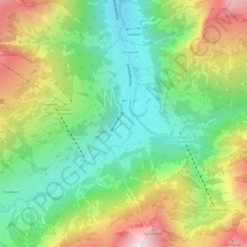
Name: Elm topographic map, elevation, terrain.
Location: Elm, Glarus Süd, Glarus, 8767, Switzerland (46.89888 9.15190 46.93888 9.19190)
Average elevation: 1,388 m
Minimum elevation: 878 m
Maximum elevation: 2,210 m
Other topographic maps
Click on a map to view its topography, its elevation and its terrain.