
City of Watervliet topographic map
Interactive map
Click on the map to display elevation.
About this map
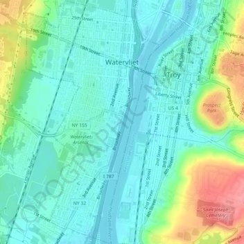
Name: City of Watervliet topographic map, elevation, terrain.
Average elevation: 25 m
Minimum elevation: -2 m
Maximum elevation: 95 m
Other topographic maps
Click on a map to view its topography, its elevation and its terrain.
Town of Guilderland
United States > New York > Albany County
Town of Guilderland, Albany County, New York, United States
Average elevation: 126 m
Alcove
United States > New York > Albany County > Town of Coeymans
Alcove, Town of Coeymans, Albany County, New York, 12007, United States
Average elevation: 209 m
Karlsfeld
United States > New York > Albany County > City of Albany
Karlsfeld, City of Albany, Albany County, New York, 12159, United States
Average elevation: 57 m
City of Albany
United States > New York > Albany County
City of Albany, Albany County, New York, United States
Average elevation: 68 m