Geolocate

North Anderson topographic map

Click on the map to display elevation.

About this map
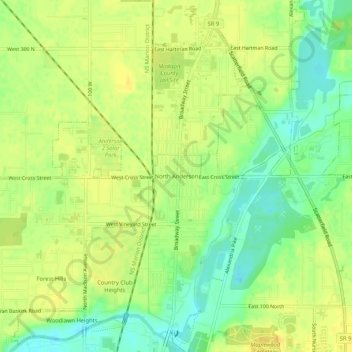
Name: North Anderson topographic map, elevation, terrain.

Location: North Anderson, Anderson, Madison County, Indiana, 46012, United States (40.11532 -85.69803 40.15532 -85.65803)

Average elevation: 268 m

Minimum elevation: 253 m

Maximum elevation: 277 m

Other topographic maps

Click on a map to view its topography, its elevation and its terrain.
Gear up for your next adventure:

🧴Insect Repellent - Protect yourself from bugs during outdoor adventures
🚲MTB Frame Bag - Carry tools and maps directly on your bicycle frame
🥾Waterproof Trail Shoes - Shoes designed to handle wet terrain
🔭Compact Monocular - One-handed bird watching and trail spotting
🦯Trekking Poles - Reduced impact on joints for steep topographic climbs

As an Amazon Associate, this site earns from qualifying purchases at no extra cost to you.