
Make a donation
Gear up for your next adventure:
As an Amazon Associate, this site earns from qualifying purchases at no extra cost to you.
Lawndale topographic map
Click on the map to display elevation.
Make a donation
Gear up for your next adventure:
As an Amazon Associate, this site earns from qualifying purchases at no extra cost to you.
About this map
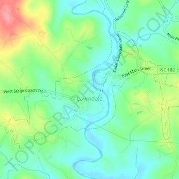
Name: Lawndale topographic map, elevation, terrain.
Location: Lawndale, Cleveland County, North Carolina, United States (35.40609 -81.57968 35.42467 -81.54486)
Average elevation: 268 m
Minimum elevation: 238 m
Maximum elevation: 329 m
Make a donation
Gear up for your next adventure:
As an Amazon Associate, this site earns from qualifying purchases at no extra cost to you.
Other topographic maps
Click on a map to view its topography, its elevation and its terrain.
Moss Lake Park II (Westside)
United States > North Carolina > Cleveland County > Kings Mountain
Average elevation: 231 m
Make a donation
Gear up for your next adventure:
As an Amazon Associate, this site earns from qualifying purchases at no extra cost to you.