
Padrón topographic map
Interactive map
Click on the map to display elevation.
About this map
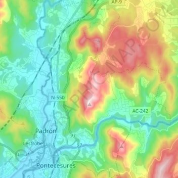
Name: Padrón topographic map, elevation, terrain.
Location: Padrón, O Sar, Ла-Корунья, Галисия, Испания (42.71224 -8.68611 42.80745 -8.57135)
Average elevation: 139 m
Minimum elevation: -1 m
Maximum elevation: 435 m