
Thank you for supporting this site ❤️
Make a donation
Make a donation
Gear up for your next adventure:
As an Amazon Associate, this site earns from qualifying purchases at no extra cost to you.
Espedrada topographic map
Click on the map to display elevation.
Thank you for supporting this site ❤️
Make a donation
Make a donation
Gear up for your next adventure:
As an Amazon Associate, this site earns from qualifying purchases at no extra cost to you.
About this map
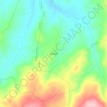
Name: Espedrada topographic map, elevation, terrain.
Location: Espedrada, Freixedas, Pinhel, Guarda, 6400-212, Portugal (40.65268 -7.21316 40.69268 -7.17316)
Average elevation: 651 m
Minimum elevation: 562 m
Maximum elevation: 822 m
Thank you for supporting this site ❤️
Make a donation
Make a donation
Gear up for your next adventure:
As an Amazon Associate, this site earns from qualifying purchases at no extra cost to you.