Geolocate

Golden Eagle topographic map

Click on the map to display elevation.

About this map
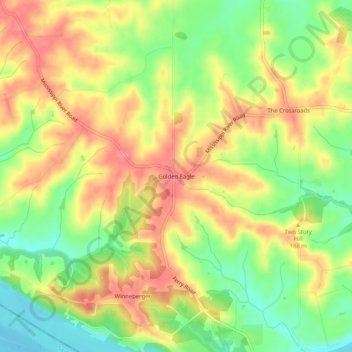
Name: Golden Eagle topographic map, elevation, terrain.

Location: Golden Eagle, Calhoun County, Illinois, 62036, United States (38.87338 -90.59901 38.91338 -90.55901)

Average elevation: 170 m

Minimum elevation: 129 m

Maximum elevation: 206 m

Other topographic maps

Click on a map to view its topography, its elevation and its terrain.

Brussels

United States > Illinois > Calhoun County

Average elevation: 148 m

Gear up for your next adventure:

🔋Solar Power Bank - Keep your GPS and devices charged during long outdoor trips
🧣Merino Neck Gaiter - Protects against wind, sun, and cold at high altitudes
🧦Merino Wool Socks - Moisture-wicking comfort for long-distance hiking
🧰Emergency Multi-Tool - Compact multi-tool for outdoor survival
🛁Quick-Dry Microfiber Towel - Space-saving towel that dries rapidly on the move

As an Amazon Associate, this site earns from qualifying purchases at no extra cost to you.