
Centro Cultural dos Jesuítas topographic map
Interactive map
Click on the map to display elevation.
About this map
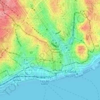
Name: Centro Cultural dos Jesuítas topographic map, elevation, terrain.
Average elevation: 43 m
Minimum elevation: -6 m
Maximum elevation: 119 m
Other topographic maps
Click on a map to view its topography, its elevation and its terrain.
Santo Estévão
Portugal > Lissabon > Lissabon
Santo Estévão, Alfama, Santa Maria Maior, Lissabon, Portugal
Average elevation: 20 m