Geolocate

Circleville topographic map

Click on the map to display elevation.

About this map

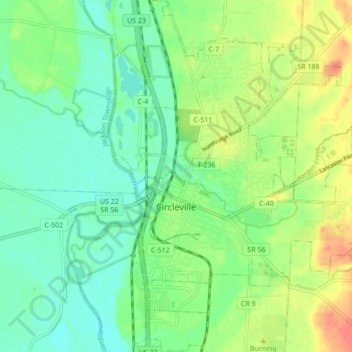
Name: Circleville topographic map, elevation, terrain.

Location: Circleville, Pickaway County, Ohio, 43113, United States (39.57316 -82.96251 39.63961 -82.89696)

Average elevation: 212 m

Minimum elevation: 193 m

Maximum elevation: 243 m

Other topographic maps

Click on a map to view its topography, its elevation and its terrain.

Derby

United States > Ohio > Pickaway County

Average elevation: 278 m

Hargus Lake

United States > Ohio > Pickaway County

Average elevation: 260 m

Whisler

United States > Ohio > Pickaway County

Average elevation: 249 m

Gear up for your next adventure:

🧰Emergency Multi-Tool - Compact multi-tool for outdoor survival
🔦LED Flashlight - Powerful and long-lasting flashlight for camping and emergencies
💡LED Camping Lantern - Illuminate your campsite with long-lasting lanterns
🧥Packable Rain Jacket - Breathable waterproof layer for unpredictable weather
📷Outdoor Action Camera - Capture high-elevation views and rugged adventures

As an Amazon Associate, this site earns from qualifying purchases at no extra cost to you.