Geolocate

Mount Comfort topographic map

Click on the map to display elevation.

About this map

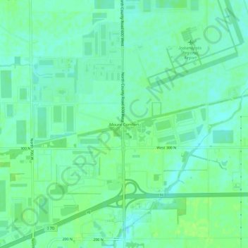
Name: Mount Comfort topographic map, elevation, terrain.

Location: Mount Comfort, Hancock County, Indiana, United States (39.81086 -85.93500 39.85086 -85.89500)

Average elevation: 262 m

Minimum elevation: 256 m

Maximum elevation: 266 m

Other topographic maps

Click on a map to view its topography, its elevation and its terrain.

Fortville

United States > Indiana > Hancock County

Average elevation: 263 m

Wilkinson

United States > Indiana > Hancock County

Average elevation: 307 m

Spring Lake

United States > Indiana > Hancock County

Average elevation: 259 m

New Palestine

United States > Indiana > Hancock County

Average elevation: 253 m

Cumberland

United States > Indiana > Hancock County

Average elevation: 261 m

Gear up for your next adventure:

🧢Hiking Sun Hat - Wide-brimmed protection for exposed mountain ridges
🥾Light Hiking Boots - Lightweight and comfortable boots for day hikes
🥾Trail Hiking Shoes - Durable shoes designed for rugged trails
🦟Insect Repellent - Keep mosquitoes and black flies away in wooded areas
🚲Handlebar Phone Mount - View topographic-map.com live while cycling

As an Amazon Associate, this site earns from qualifying purchases at no extra cost to you.